You can do salt maps for just about any region - here are the steps!
 You will need: salt (a lot of it), flour and water. You will need a map of the area you want to use, enlarged to 11x17 (or close to that.) You will need a piece of cardboard. The inside of a clean pizza box will work well. We had a lot of boxes from our move, so we just cut a size that worked for us. You will also need a marker and some tempura paints.
 |
| Map blown up to 11x17 size |


 Step 2: Put the map on the cardboard piece and trace the map lines, pressing firmly.
 Step 3: You will be able to see a light line, which can then be drawn over with a marker to make it easier to see.
 Step 4: Mix up 1-2 cups of flour and 1-2 cups of sugar (equal amounts) and then add water until you get a playdoh kind of consistency.
Step 5: Begin pressing the dough onto the cardboard within the lines drawn. Use flour on your fingers if it starts to stick to the figers more than the cardboard!
The lines will be a little rough, which makes it look more like a shoreline.
 |
| Our nearly finished salt map - the Roman Empire |
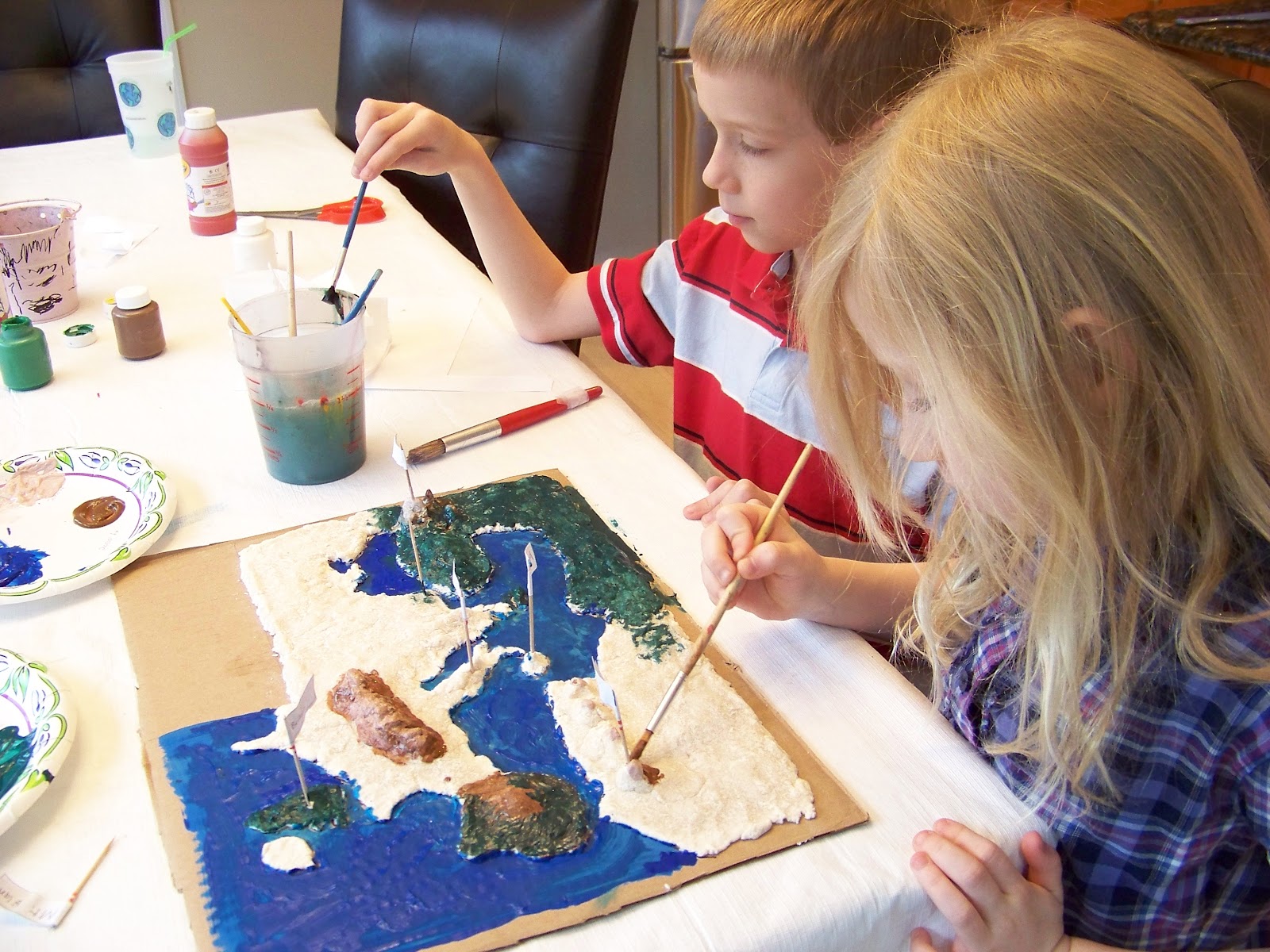 Step 7: Now get out your Atlas and the kids look closely at the geographic layout of the land. I had the kids make a chart for 500 ft, 2000 ft, 5,000 ft and so on. They made colors for each catagory and then referred to their Atlas to make it as realistic as possible.
We also made some "flags" marking some key areas (of their choosing) during that time in history - and today!
 |
| Our finished map. The glare doesn't show the label at the top right, which reads: Ancient Times, Roman Empire. |
And that's all there is to it! Now we all remember where the Roman's lived in those times - even I now remember. :-)
No comments:
Post a Comment